The Map tab contains the following controls:
The Map tab
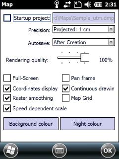
[ ] Startup Map: Displays the PATH to the map project that TopoLynx topoXplore opens at startup. When this check-box checked the PATH is clickable as a button to open the Open map file panel to change the preset map project. Default is unchecked.
![]() Please not when using the Startup Map option in TopoLynx topoXplore the Startup options panel not appears at startup.
Please not when using the Startup Map option in TopoLynx topoXplore the Startup options panel not appears at startup.
Precision: Controls the precision of the displayed map view coordinates. Working with lower map precision is useful if your mobile device's free program memory is nearly equal or lower than the used program memory of vector layers you wish to add in your mapping project.
Free program memory in Windows Mobile
Selectable values
•Projected: 1 m projected coordinates, precision is 1 meter
•Projected: 1 dm projected coordinates, precision is 1 decimeter (0.1 meter)
oProjected: 1 cm projected coordinates, precision is 1 centimeter (0.01 meter) - default value for local projection systems
•Projected: 1 mm projected coordinates, precision is 1 millimeter (0.001 meter)
•Geographic: 10 m geographic coordinates, precision is 10 meters
•Geographic: 1 m geographic coordinates, precision is 1 meter
•Geographic: 1 dm geographic coordinates, precision is 1 decimeter (0.1 meter)
oGeographic: 1 cm geographic coordinates, precision is 1 centimeter (0.01 meter) - default value for WGS reference systems
![]() Until you have not saved the current mapping project and it does not contains a layer the precision can be changed.
Until you have not saved the current mapping project and it does not contains a layer the precision can be changed.
Autosave: Controls the saving of edited vector layers, text and tabular formats. Default is After Creation.
![]() The vector geometry and its attributes will be saved automatically when they are created.
The vector geometry and its attributes will be saved automatically when they are created.
Rendering quality: provides a way to switch to an alternative rendering mode for your data to make your map draw faster if necessary.
Default values
•240x320 screen resolution and in the Desktop version: 100%
•480x640 screen resolution: 50%
![]() The rendering quality can be changed at runtime without the need of restarting the application.
The rendering quality can be changed at runtime without the need of restarting the application.
Full-Screen: Enables the full-screen display mode to increase the workspace.
Full-screen mode is turned on (first screenshot) and turned off
Full-screen mode in the Desktop version
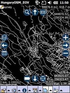
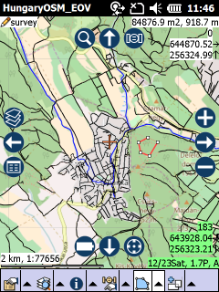
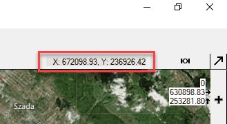
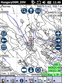
Coordinate display: Controls the coordinate display on the map and on the Pan frame in the Desktop version as.
1.Current GNSS position in the bottom right corner
2.Last GNSS position at the same location
3.Queried map position in the top right corner
4.Current cursor position on the Pan frame
1. Current GNSS position in the bottom right corner
2. Queried map position in the top right corner
3. Current cursor position on the Pan frame
Raster smoothing: Enables bi-linear interpolation raster pixels in the map view so the raster layer will not be pixels picture
Speed dependent scale: Changes the current scale on the basis of the actual speed.
Pan frame: Active navigation frame around the map view with the frequently used tools. Untick the check-box if you don't wish to use it.
Continuous drawing: provides a way to switch to an alternative rendering mode for your data to make your map draw faster if necessary.
Default values
•Unchecked in the Mobile version
•Checked in the Desktop version
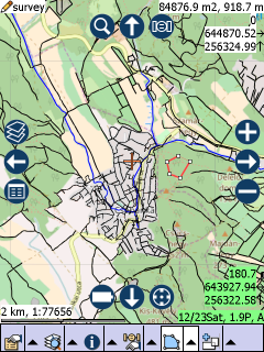
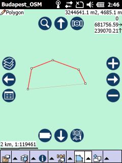
Map Grid: displays a map grid based on the current map projection on the map view. The size of each grid cell is automatically calculated, based on the current map scale.
Map Grid on the map view
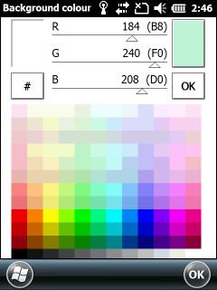
Background colour: Opens the colour palette to set the background colour of the map view (default is white).
The "Background colour" colour palette and the selected grey background colour on the map view
Night colour: Opens the Night colour dialog to set or turn off the tint colour of the night screen.
The Night colour panel
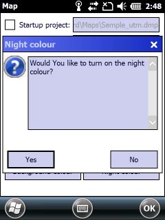
Night colour
OK - Opens the Night colour colour palette.
Turn off - Turns off the current night colour (black colour switches the night colour off also).
Before and after the applied "white" night colour