This tool is accessible in the Project menu, or by clicking on the  Online Data Sources button in the toolbar (Desktop version)
Opens the Online Data Sources panel to use a background map layer as the lowermost layer of the map view. The background map layer not displays in the Layers panel.
Online Data Sources panel
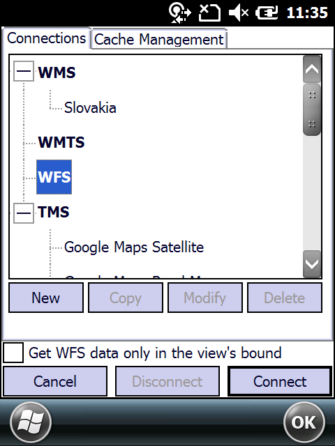
The Online tab allows you to access online imagery services such as Web Map Services or built-in Tile Map Services.
The Cached imagery content of the previously used WMS, WMTS or TMS online data sources can be accessed via the Offline tab. On this tab you can import a background map layer: in Mobile Atlas Creator .ZIP or SQLite files with any extension.
![]() Please Note: The background map layer not displays under scale: 1:10 000 000 if the map view is in a local projected spatial reference system.
Please Note: The background map layer not displays under scale: 1:10 000 000 if the map view is in a local projected spatial reference system.