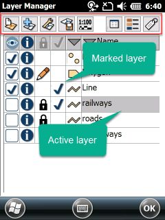
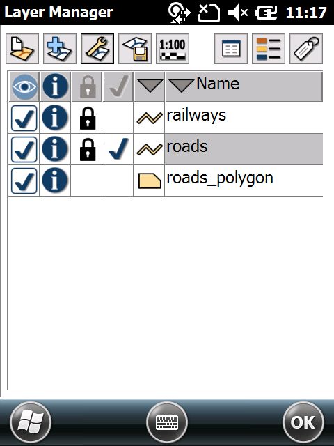
The Layers panel contains the following buttons:
Opens a pop-up menu with the following options:
oFile: Opens the Create layer file panel to create a new vector layer
More details about the relevant commands to this button can be found in the New Layer topic.
Opens a pop-up menu with the following options:
oFile: Opens the Append layer panel file to add one or more layers to the map view
More details about the relevant commands to this button can be found in the Append layer topic.
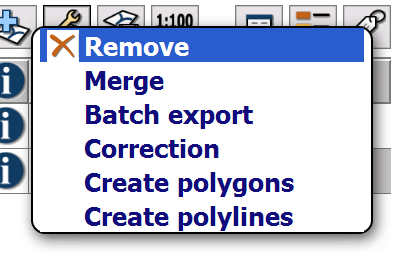
Opens a pop-up menu with the following options:
oRemove: Removes selected layers from the list
oMerge: Merges selected layers from the list. The merged layers can be saved into a new vector layer file.
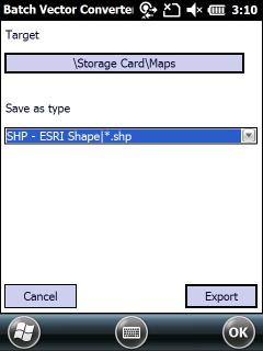
oBatch export: Saves the selected layers into a specified location in a specified format.
oCorrection: Special function to apply correction data for post-processing if you use CHC LT500H/T devices with Raw data collection.
oCreate polygons: Topological function to create polygons from intercepting lines or polygons from the selected layers. TopoXplore will examine the lines and creates the polygons automatically and save them to a new layer. You can also use filtering functions to create polygons only from the visible items from the selected layers. Note that the lines must reach or intercept each others in order to create the polygons.
oCreate polylines: Topological function to create polylines from intercepting lines or polygons. TopoXplore will examine the lines and creates the polylines automatically and save them to a new layer. You can also use filtering functions to create polygons only from the visible items.
Layer operations - pop-up menu
Batch export panel
Layer with lines
Polygon layer created from polylines
Polygon layer created from polylines on the map
Note: not all the lines are intercepting!
![]() Only the selected vector layers can be merged into MAP, DGN, DXF and MIF multi feature vector format: more than one feature type i.e. point, line and polygon within one layer
Only the selected vector layers can be merged into MAP, DGN, DXF and MIF multi feature vector format: more than one feature type i.e. point, line and polygon within one layer
Opens a pop-up menu with the following options:
oFile: Opens the Save as file panel file to export the active layer into another file format or to save it with a different new name.
More details about the relevant commands to this button can be found in the Save layer topic.
Opens the Scale panel. Sets the display scale range of the layers.
Opens different Source paneles by data source type as:
oVector layers, text and tabular files
to display and edit the properties of the data source.
![]() Layer classification, edit classes
Layer classification, edit classes
Opens different paneles by data source type as:
oVector layers --> Classes panel. The Classes panel lists all the thematic classes to the active TopoLynx topoXplore vector layer as well as the symbology defined for the layer.
oRaster layers --> Raster Options panel
Opens the Labels panel. Labels a vector layer with the contents of the selected attribute field. Sets label properties.